|
|
|||||
|
|
|||||
|
|
|||||
 |
|||||
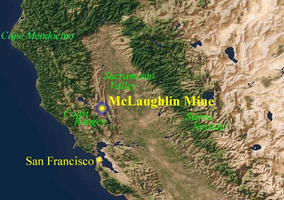
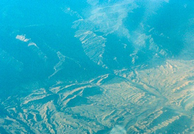
| The McLaughlin mine lies 115 km north of San Francisco in the Coast Ranges geomorphic province of Northern California. The deposit formed at the fault boundary between Mesozoic lithotectonic units called the Coast Range Ophiolite and the Great Valley Sequence. | |||||
 |
|||||
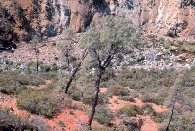 |
To the west of the fault is the Jurassic Coast Range Ophiolite, made up of intensely tectonized seafloor ultramafic rock (serpentine), mafic volcanics (greenstones) and metasediments. Vegetative cover on the ophiolite includes a mixture of species that are either endemic to, or tolerate, the harsh soils that the serpentine produces. The image at left shows a typical serpentine chaparral landscape of the district. The trees are gray pines (Pinus sabiniana). D. Koontz photo. | ||||
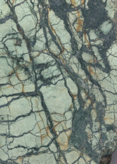
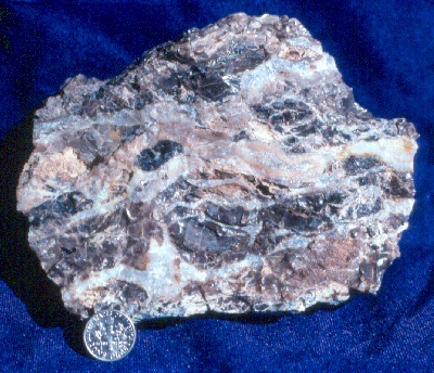
| Metabasalt and metagabbro (greenstone) blocks in the ophiolite often stand in bold relief above the less resistant tectonized ultramafic matrix of a serpentine melange belt. At right is a greenstone "knocker" rising above serpentine chaparral covered slopes near Hunting Creek. D. Enderlin photo. | 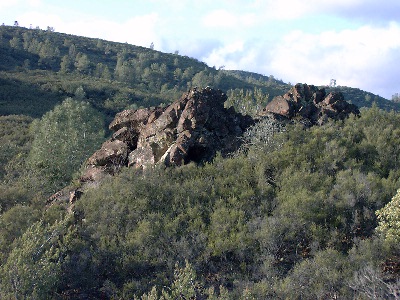 |
||||
 |
To the east of the fault is the Great Valley Sequence, an upturned assemblage of Cretaceous-Jurassic forearc basin marine sediments. Most of the formations are lenticular and have poorly expressed mappable boundaries. Hence, they are not true formations. Nevertheless, geologists have tried to assign formation names to units within the sequence in efforts to assist with stratigraphic interpretation! An aerial view of the upturned beds appears at left. N. Lehrman photo. | ||||
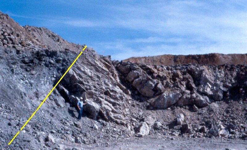
| The oldest formation of the Great Valley Sequence is the Upper Jurassic Knoxville (Stony Creek) formation, which makes up the "hanging wall" of the Stony Creek fault at the McLaughlin mine. The image at right shows the typical Knoxville formation landscape of grassland and oak woodland (foreground) abruptly bounded by the Stony Creek fault (yellow dashed line). The chaparral-covered slopes in the distance are underlain by Coast Range Ophiolite. The Knoxville formation hosts a variety of fossil fauna, including the pelecypod, Buchia piochii (Gabb), an index fossil representing the Tithonian Age of the Upper Jurassic. D. Enderlin photo. | 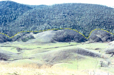 |
||||
| At right, is a side view of the Upper Jurassic pelecypod, Buchia piochii (Gabb), in a lime-rich clay bed (marl) in the Knoxville formation southeast of the McLaughlin mine. For you Jurassic Park fans, this clam was a contemporary of more familiar terrestrial fossils of North America: Allosaurus, Stegosaurus, and the enormous sauropods Apatosaurus (originally called Brontosaurus) and Diplodacus. B. piochii was also a contemporary of the famous transitional bird-theropod, Archaeopteryx, of Bavaria. D. Enderlin photo. | 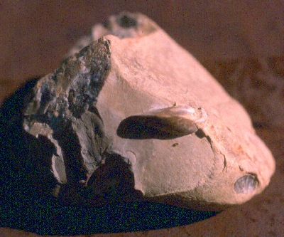 |
||||
| At right, are examples of the fossil belemnite Cylindroteuthis tehamaensis (Stanton), from the Knoxville formation near the McLaughlin mine. In older literature, the belemnite is called Belemnites tehamaensis. D. Enderlin photo. | 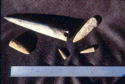 |
||||
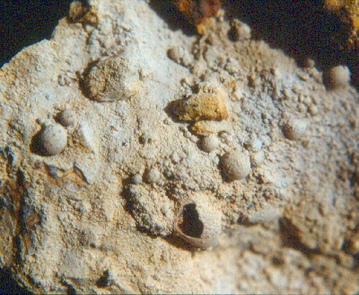
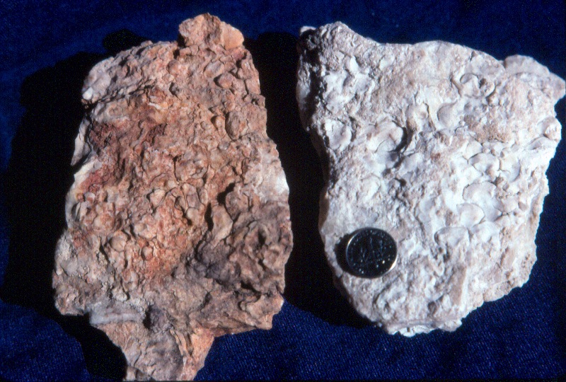
| Examples of the brachiopod Peregrinella whitneyii, found in podiform limestone beds in the upper Knoxville formation north of the McLaughlin mine. These limestones are a peculiarity in these deep ocean sediments. Recent research has revealed that these fauna are related to modern counterparts in the Marianas Trench. Submarine serpentine mud volcanoes are found in deep trenches, and are represented in the Great Valley Sequence by lenses of detrital serpentine, such as that found at Little Blue Ridge. Cold mineral water seeps associated with the volcanoes are thought to produce chemo-symbiotic microchemical environments in the deep ocean allowing such species to survive (K. Campbell personal communication). Normally, such animals would die in deep ocean environments below about 4.5 km (the Carbonate Compensation Depth), because their calcareous shells would dissolve! D. Enderlin photo. | 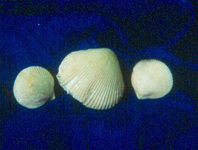 |
||||
| A large fragment of the ammonite Phylloceras knoxvillense (Stanton), found near the McLaughlin mine. To read more about the discovery of this fossil, click here. D. Enderlin photo. | 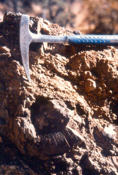 |
||||
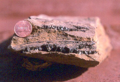 |
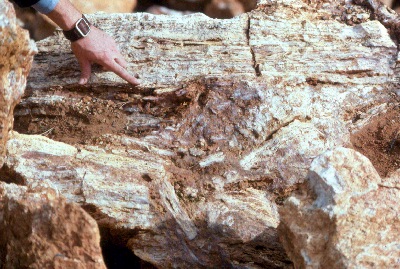
The Knoxville formation is dominated by deep ocean mudstones and siltstones in its lower strata. Near the top of the formation, rhythmically bedded sandstones and siltstones with minor chert/volcanic pebble conglomerates are common. At left is a sandstone (graywacke) from high in the section. Note the seams of bitumen (a coal-like material) in the strata. This sample was collected along the south shoreline of Davis Creek Reservoir. D. Enderlin photo. | ||||
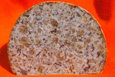 |
Stratigraphically above the Knoxville formation is the Cretaceous Crack Canyon formation. Unlike the Knoxville formation, the Crack Canyon formation contains an abundance of coarser clastics, including boulder conglomerate. At left is a polished granitic cobble from this formation, collected at the west abutment of Davis Creek Dam (Hobbit Mountain). The provenance for clasts such as this is thought to be the ancestral Klamath Mountains. D. Enderlin photo. | ||||
| The Mesozoic deposits were emplaced during a prolonged period of plate subduction, wherein an oceanic crustal plate was colliding with, and diving beneath, the North American Plate. The illustration at right shows how this process occurred. The volcanic arc on the right side of the illustration is the ancestral Sierra Nevada. N. Lehrman graphic. | 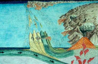 |
||||
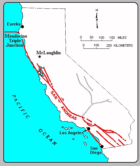
| Approximately 3 million years ago, the leading edge of the San Andreas Fault system (the Mendocino Triple Junction) migrated northward past what is now the San Francisco Bay Area. In its wake, subduction ceased and was replaced by transform (right lateral strike-slip) plate motion. Regional uplift and transtensional fault activity in the Coast Ranges produced numerous structural basins (including Morgan Valley) in the region. The map below shows the present location of the Mendocino Triple Junction and San Andreas Fault relative to the McLaughlin mine. Adapted from CDMG map. | |||||
 |
|||||
| Extensional tectonics, combined with thinning of the lithosphere in the wake of the Mendocino Triple Junction, produced regional volcanic activity. The McLaughlin deposit lies in the northernmost and youngest of the volcanic fields produced by this process. This field is called the Clear Lake Volcanics, and its age ranges from about 2.2 million years ("Ma") to about 10,000 years. The field is still potentially active, with magma bodies lying beneath Clear Lake and The Geysers. The image at right is a geologic map extracted from the CDMG Santa Rosa 1:250,000 quadrangle. The Clear Lake volcanics are shown in an orange-colored belt extending from the lower right to the upper left of the map. | 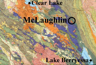 |
||||
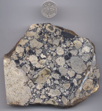 |
Clear Lake Volcanics in the vicinity of the McLaughlin mine are the oldest in the field (K-Ar age = 2.2 +/- 0.2 Ma). They are basaltic andesite intrusives that ascended along kinks and bends in the Stony Creek fault plane when the fault was still active. The initial eruptions were phreato-magmatic and explosive in nature, driven by highly fluidized mixtures of magma and wallrock (diatremes). The first eruptions emplaced broad blankets and conical craters (maars) of volcanic debris (agglomerate) across what was then a lake- or marsh-filled valley. The image at left shows a typical agglomerate, with subrounded clasts of argillized basaltic andesite and various other wallrock lithic fragments (including adularized mudstone). D. Enderlin image. | ||||
| As surface water boiled away or was displaced by surface volcanic deposits, the eruptions changed to lava flows which spread across the gentle topography of the basin to form a continuous protective cover. Today, these flows appear as harsh, rocky slopes with scattered blue oaks and thin grassland cover. The image at right was taken on the ridge just northwest of the mine pit. McLaughlin mine photo. | 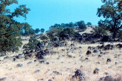 |
||||
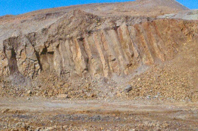 |
At left is a basaltic andesite lava flow exposed at the McLaughlin mine North Pit. This particular flow shows columnar joint patterns similar to those seen at Devil's Tower, WY and Devil's Post Pile, CA. The joints are polygonal fractures produced in certain types of lava during cooling. D. Enderlin photo. | ||||
| In the last two million years, the topography has inverted, and the ancient lava-filled valley is now a high point in the watershed, protected by the resistant lava carapace. The image at right shows the approximate limit of the lava flows (shown in yellow) on a 1981 aerial photo. The "San Quentin" workings of the old Manhattan mine appear as a white area near the center of the view. Total length of the volcanic cover is about 2 miles. D. Enderlin graphics. | 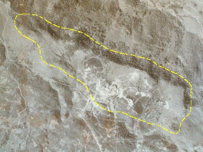 |
||||
 |
Like The Geysers geothermal system west of Clear Lake (left), the McLaughlin gold deposit was formed from geothermal heat. Shallow ore deposits of this type are classified as epithermal deposits. The heat that formed the McLaughlin deposit came from the local magmatic activity. It is thought that the driving heat source for the McLaughlin deposit was a second pulse of magma, which ascended about 1 million years after the local basaltic andesite eruptions. This second episode may have involved a larger, perhaps silicic, magma body of a scale large enough to sustain hot springs activity for several hundred thousand years. Photo courtesy The Bancroft Library. | ||||
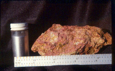
| Prior to the onset of gold mineralization, the initial geothermal activity in the district produced chemical alteration of certain rock types that were adjacent to the thermal pathways in the faults. One of the most common types of alteration is a rock called "silica-carbonate," that is the byproduct of the interaction of carbonated thermal waters with serpentine. The image at right is silica-carbonate, where the serpentine is entirely replaced by common opal. The carbonate portion (usually magnesite) is not always present. D. Enderlin photo. | 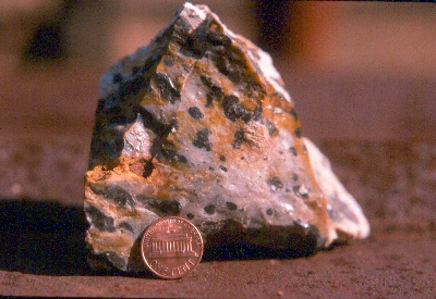 |
||||
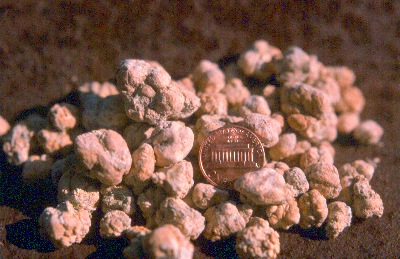 |
Magnesite (magnesium carbonate) is found throughout the region. It often appears as irregular nodules replacing serpentine, as shown in the image at left. High quality magnesite crystals were also found in the McLaughlin mine pit. D. Enderlin photo. | ||||
| The opal content of silica-carbonate rock tends to make it more resistant to erosion than the softer surrounding formations. As a result, silica-carbonate zones often stand out in bold relief to the surrounding landscape. The silica-carbonate spire at right is called the "pinnacles" or "eagle rocks." It is located north of the McLaughlin mine pit, and is directly in the plane of the Stony Creek fault. In the early days, miners used to call this rock "quicksilver rock," because its brittle nature made it a favorable host rock for vapor-phase mercury enrichment. McLaughlin mine photo. | 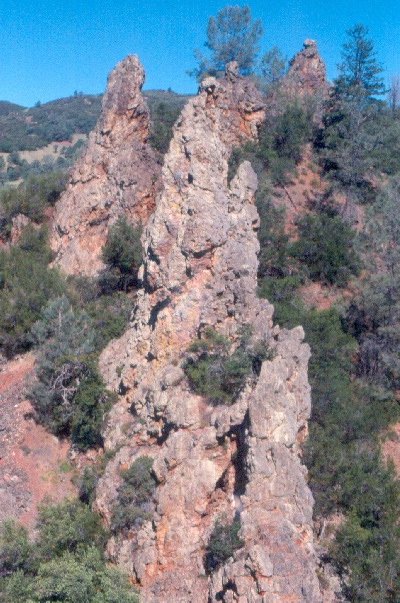 |
||||
 |
An odd, but widespread, texture found in silica-carbonate alteration is the "froth vein," named for the bubbly appearance it presents. When intact, the silica bubbles usually contain globules of bitumen, tar or flowing oil. They are an example of a type of fluid inclusion. In the Redington mine, a cavity reportedly yielded several barrels of flowing green oil many years ago. The miners collected some of it, and mostly out of curiosity, used it to lubricate their mining equipment! The specimen at left comes from the Reed mine. D. Enderlin photo. | ||||
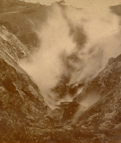
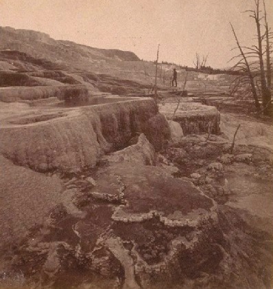
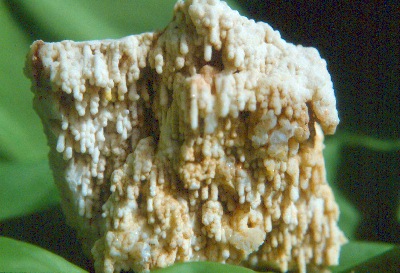
| An intact subaerial sinter (siliceous hot spring deposit) capping a portion of the multistage gold vein system was an especially important feature of the McLaughlin deposit, in that it demonstrated that the deposit was a completely preserved hot springs-type epithermal system. K-Ar ages from vein adularia and hypogene alunite bracket the age of the system between 1 Ma and 0.5 Ma. The sinter terraces formed a hill which was known as the San Quentin. When the hot springs were active, the terraces would have formed in the same manner as those of Yellowstone (see historic view of Mammoth hot springs at right). Click here to see examples of the San Quentin sinter from McLaughlin. Photo courtesy The Bancroft Library. |
 |
||||
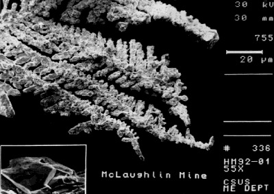 |
Gold (primarily as electrum) precipitated as dendritic growths associated with silver sulfosalts in a zone of boiling extending over 350 m beneath the level of the sinter cap. Dissolved gold precipitated in this zone because, at shallow levels, where the confining pressure of the rock was reduced, hydrogen sulfide gas effervesced out of the water. Deeper in the system, where hydrogen sulfide stayed dissolved, it formed an ionic complex with gold and silver. These "bisulfide" complexes are what transport dissolved precious metals upward to the shallow hot springs zone of deposition. The ore-forming fluid was of meteoric origin, with recharge of the convective geothermal cell being enhanced by favorable Middle Pleistocene paleoclimatic and geomorphologic factors. At left is a scanning electron photomicrograph image of McLaughlin mine gold dendrites. Image courtesy California State University Sacramento geology dept. | ||||
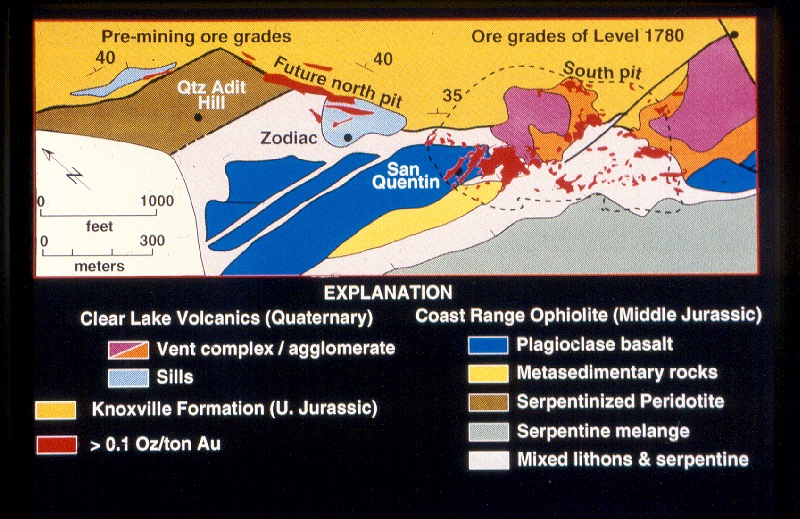
| The fluid pathways for the hot-spring system were localized along a northwest-striking segment of the complexly deformed Stony Creek fault. The intrusives, along with brittle and/or silicified lithons in the ophiolite and adularized horizons in the Knoxville (Sulfur Creek) formation of the Great Valley Sequence, served as the flow paths for the ascending hot-spring fluids. The system was driven by a paleothermal anomaly related to regional magmatism of the Clear Lake Volcanics. The image below shows the relative positions of the orebody to the key geologic units of the deposit. USGS graphics. | |||||
 |
|||||
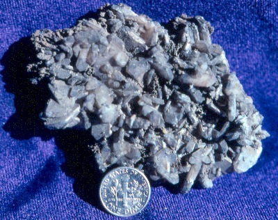
| The formation of the gold vein stockwork was characterized by syntectonic multistage vein filling of extensional fractures. With the sealing of the system in the course of each vein filling cycle, the system would fracture in response to overpressuring and tectonic dilation. As a result, pervasively hydrofractured wallrock and hydrothermal eruption breccias were common near the surface of the system. The image at right shows a fist-sized specimen with at least 5 generations of veining. D. Enderlin photo. | 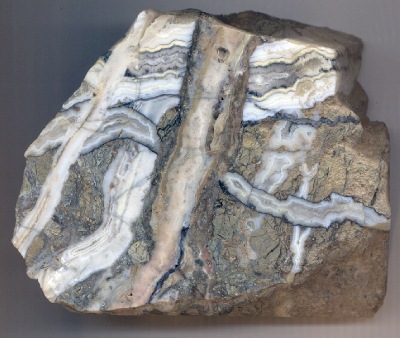 |
||||
| Precious-metal-bearing veins were dominantly crustiform - colloform quartz, chalcedony and opal, up to tens of centimeters in width. Veins typically occurred in mutually crosscutting swarms, having orthogonal relationships to nearby fault shears. The veins tended to be steeply dipping, with varying orientations corresponding to complexly evolving local strain fields. The most impressive of all the vein swarms was a massive zone of vein filling known as the "sheeted vein." It formed the root of the San Quentin sinter, and accounted for approximately 25% of the total gold production at the McLaughlin mine. The image below shows the sheeted vein as it appeared at the mining face in 1987. The yellow line marks the upper boundary of the vein zone. To the left of the boundary is unaltered polymictic melange (cataclasite). D. Enderlin photo. | |||||
 |
|||||
| The "sheeted vein" zone plunged eastward at an angle of about 25 degrees from horizontal. Its outcrop was adjacent to the San Quentin sinter terrace. It formed on the southeast edge of a large tectonic block (lithon) of metabasalt. A complex zone of strain, where convergent faults deflected around this large block, produced a "pressure shadow" or dilatent zone where the sheeted vein zone formed. The repeated tearing apart of rock along this edge, drew fluids into the resulting cracks and voids occasionally with high enough velocity to produce fluid "throttling." Where evidence of this was found, the vein matter often contained coarse gold and vein textures indicative of extreme supersaturation of silica with respect to quartz. Syneresis cracks and colloform bands in some of the veins give us clues that silica was precipitating at such a rapid rate near the throttling zones that it initially deposited in a gelatinous state. With time, it dehydrated and recrystallized. The picture below shows syneresis (shrinkage) cracks in chalcedony from the sheeted vein (right) and a comparative sample with similar syneresis textures from the Linn vein in the Calistoga Mining District (a nearby precious metals mining district in the Coast Ranges). The cracks appear as small, arcuate fissures on the surfaces of the chalcedony veins. D. Enderlin photo. | |||||
 |
|||||
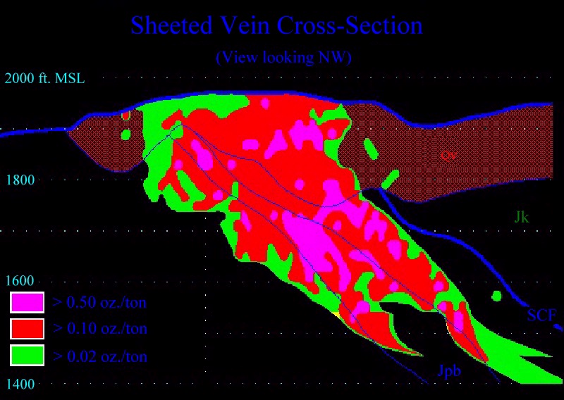
| The enormity of the sheeted vein zone was especially striking when viewed in cross-section. The image below is a profile of average gold concentrations in the zone. This model is based on assay results of blastholes collected during the course of mining. The bold blue line (marked SCF) to the right of the sheeted vein is the Stony Creek Fault. Surficial volcanics are marked Qv. D. Enderlin graphics. | |||||
 |
|||||
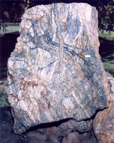
| A
large example from the sheeted vein zone is preserved in Homestake's interpretive
rock display ("Stonehenge") at the core library. The boulder at right measures
about two meters tall, and is representative of the upper portion of the
sheeted vein. The boulder was collected from a zone that assayed about
0.40 oz. Au per ton.
The sheeted vein was the oldest of the orebodies at the McLaughlin mine, and by far the most spectacular. The long-lived and highly permeable fracture system that hosted the sheeted vein, provided the ideal conditions to convey an enormous volume of water to the surface. The high quantity of silica-saturated water that emerged from the outflow point of the sheeted vein is responsible for the formation of the San Quentin sinter terraces that deposited nearby. Photo courtesy J. Farmer, NASA-Ames Research Center. |
 |
||||
 |
The hot springs that formed the McLaughlin deposit were by no means passive. With temperatures well above 200 degrees Celsius in the heart of the sheeted vein, the springs frequently sealed, overpressured, and exploded. Each hydrothermal explosion event would fragment the surrounding rock (hydrofracturing), producing new pathways for water to ascend to the surface. The image at left shows hydrofractured Jurassic metabasalt (greenstone) from the vicinity of the San Quentin. The web of veinlets is pervasive throughout the rock (larger veinlets are about 1 mm in width). The green coloration is a chlorite-montmorillonite-celadonite clay assemblage that formed by chemical interaction of boiling hot springs water and the rock. D. Enderlin photo. | ||||
| In a hydrothermal steam eruption, rock capping the hot springs would be torn loose and often hurled through the air for short distances. Accumulations of these explosion fragments were called hydrothermal explosion breccias. The largest clasts observed at McLaughlin were over 2 meters in diameter. Smaller ones (such as those at right) had dimensions in centimeters. The bluish-white clasts are shards of sinter that were dislodged in the hydrothermal explosion. D. Enderlin photo. |  |
||||
 |
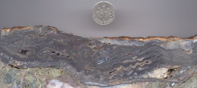
The cycle of open hot springs flow, punctuated by hydrothermal explosion events, produced a complex stratigraphy in the sinter pile. Dozens, if not hundreds, of explosion events were recorded in the layers of sinter. Each cycle would appear as a fragmental layer of hydrothermal explosion breccia capped by laminated sinter terrace deposits. These alternating rhythmic beds built up layer upon layer, to produce the San Quentin Hill. The image at left shows a hydrothermal breccia bed overlain by thinly laminated sinter. The hand points to the contact between the two. McLaughlin mine photo. | ||||
| Thermal springs were not limited to the San Quentin Hill. The photo at right shows an ancient carbonate spring south of the McLaughlin mine. The mineral deposits that form these spring terraces are tufa, rather than sinter. Their relative age with respect to the McLaughlin deposit is not known. Small saline seeps still emanate from this site, but the flow that built the terraces is no longer present. A spring terrace can be seen in the right foreground of the photo. In the distance are modern seeps emanating from a fault zone where metasediments (grassland) meet serpentinized peridotite (chaparral). D. Enderlin photo. | 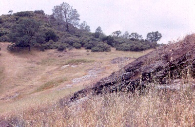 |
||||
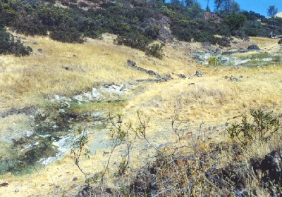 |
Although the local geothermal gradient has returned to near the average for the region, springs and seeps still emerge from highly localized fluid pathways in the district. These springs are highly mineralized, and represent the last vestiges of the processes that formed the McLaughlin deposit. The spring-seep shown at left, emerges from the ophiolite a short distance south of the McLaughlin mine pit. Such spring seeps often host unusual plant communities that take advantage of the peculiar water chemistry to avoid competition from exotic species. More information on spring seep chemistry can be found in Appendix 11 of the McLaughlin Mine Closure Plan. D. Enderlin photo. | ||||
| The sheeted vein zone in the South Pit of the McLaughlin mine serves as a modern pathway for small amounts of upwelling mineral water. The image at right shows bicarbonate-rich water violently effervescing in a shallow borehole at the bottom of the pit. N. Lehrman photo. | 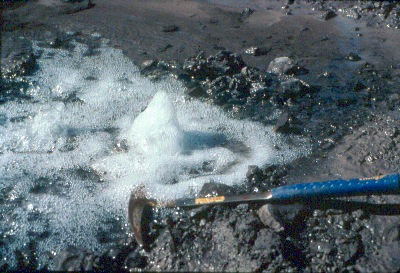 |
||||
|
|
|||||
| The variety of minerals found at the McLaughlin mine is well known and extensive. A small sampling is presented below. | |||||
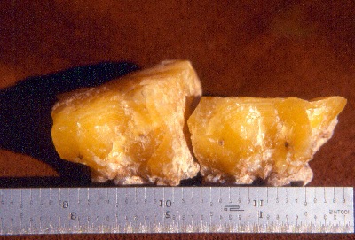 |
Lemon
Opal
A form of common opal (no fire), this opal was found at the surface in only one spot in the McLaughlin deposit. The deep yellow pigment was due to hydrocarbon impurities (probably curtisite), which also made the lemon opal fluoresce under UV light. D. Enderlin photo. |
||||
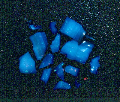
| Precious
Opal
In spite of the abundance of opal throughout the McLaughlin deposit, only one small pocket of precious opal was ever found. The samples at right display green and orange fire. N. Lehrman photo. |
 |
||||
 |
Mercury
and Cinnabar
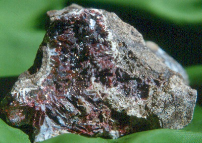
Cinnabar is the red sulfide of mercury. The image at left shows the liquid metal (mercury or quicksilver) with a piece of cinnabar from the old Gail Pit. Cinnabar was widespread in the shallow portions of the deposit, but was rarely seen as the pit was deepened. D. Enderlin photo. |
||||
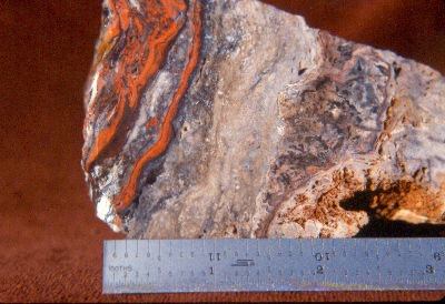
| Metacinnabar
At one time, it was thought that these black banded veins were the barium-manganese oxide, psilomelane. Later study revealed that they were composed of metacinnabar, a close "cousin" to cinnabar. The sample at right comes from San Quentin Hill. D. Enderlin scan. |
 |
||||
| Cinnabar
Cinnabar in the McLaughlin deposit often appeared as earthy replacements or as small crystals. The sample at right was collected from the Zodiac Sill in the North Pit. The crystals in this pocket were exceptionally coarse. This pocket also contained native mercury, which was extremely rare at McLaughlin. D. Enderlin photo. |
 |
||||
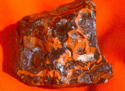
 |
Myrickite
Named for the famous Death Valley gemstone prospector, "Shady" Myrick, Myrickite is one of the more spectacular gemstones found in the McLaughlin deposit. Its alternating black and red-orange bands are metacinnabar and cinnabar, respectively, which are silicified by opal and chalcedony. D. Enderlin photo. |
||||
| Myrickite
Normal cinnabar is soft and not suitable for jewelry making. Myrickite, on the other hand, is hard enough to take a high polish. It was much sought after by rock collectors. Unfortunately, there was only one outcrop west of the McLaughlin open pit that yielded the best Myrickite. The seam was excavated prior to gold mining operations, and the best material provided to a gem dealer for sale on consignment. D. Enderlin photo. |
 |
||||
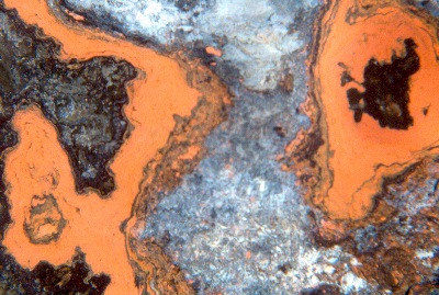 |
Myrickite
The specimen of myrickite at left has been polished to reveal the intricate color banding that makes it so desirable. D. Enderlin scan. |
||||
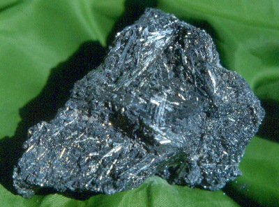
| Stibnite
Antimony minerals are relatively common in McLaughlin mine ore. Stibnite (antimony sulfide) is the most common of all the antimony minerals at McLaughlin. It usually occurs as thin silver metallic needle-like crystals in the siliceous veins. The specimen at right came from one of the better stibnite pockets found at McLaughlin, located at the north end of the South Pit. D. Enderlin photo. |
 |
||||
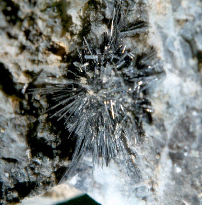 |
Stibnite
The stibnite sample at left is more typical of crystals found at McLaughlin. The "spray" of crystals measures about an inch in diameter. D. Enderlin photo. |
||||
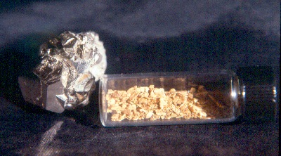
| Pyrite
(Fool's Gold)
Pyrite was widespread in the McLaughlin deposit, but generally not coarse-grained. The crystal cluster shown at right (with a vial of Mother Lode placer gold for comparison), came from an altered zone in sheared Knoxville mudstone. Such shear zones occasionally yielded pockets rich in beautiful large pyritohedrons such as this one. D. Enderlin photo. |
 |
||||
 |
Barite
Barite was relatively common along the western margin of the McLaughlin deposit. It formed as barium-enriched acid-sulfate waters from the hot springs percolated back down into portions of the deposit. Such sulfate-rich zones often also hosted stalactitic marcasite. D. Enderlin photo. |
||||
| Barite
with Quartz
The photo at right shows a cavity lined with barite crystals that have been encrusted with drusy quartz . The sample was collected from Quartz Adit Hill at the north end of the McLaughlin deposit. D. Enderlin photo. |
 |
||||
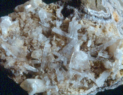 |
Aragonite
Carbonates were widespread throughout the McLaughlin deposit. Magnesite and dolomite crystals were especially common. Calcite and aragonite were less common. The sample at left shows prismatic aragonite crystals collected from vugs in metabasalt on the west margin of the South Pit. D. Enderlin photo. |
||||
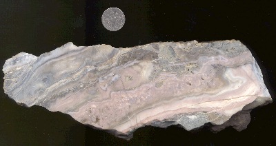
| Chalcedony
Chalcedony, the fibrous form of quartz, was widespread through all but the deepest areas that were mined in the pit. The photo at right shows colloform banding (irregular swirls) in chalcedony from an orebody known as "40-R." The sample also contains gold which isn't visible at this magnification. D. Enderlin scan. |
 |
||||
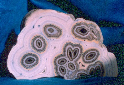 |
Chalcedony
Chalcedony can grow in countless shapes and patterns. At left is a spectacular sample collected from the North Pit. The chalcedony bands grew as crusts on freestanding scepters of calcite or dolomite. The carbonate scepters dissolved as the chalcedony formed, leaving the eye-shaped openings. Collectors often refer to banded chalcedony as "agate." D. Enderlin photo. |
||||
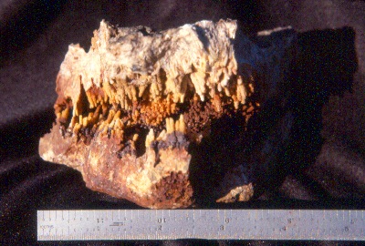
| Marcasite
The photo at right shows botryoidal and stalactitic marcasite. Marcasite is an iron sulfide, like pyrite. In this case, it formed in an acid-sulfate water recharge zone, where iron-rich acidic water was reduced by ascending hydrogen sulfide. Such recharge zones are known as "zones of mixing," and their mineralogy can be quite complex. In some areas of the South Pit, the marcasite stalactites grew to over 20 cm in length. D. Enderlin photo. |
 |
||||
 |
Framboidal
Pyrite
Under high magnification, even a common mineral like pyrite can reveal peculiar textures! The photomicrograph image at left shows framboidal pyrite from the McLaughlin deposit. Debate continues over the origin of the growth forms called "framboids." Do bacteria create them? Maybe. The number of doctoral dissertations on the subject would probably fill this CD-ROM! Homestake Mining photo. |
||||
| Barite
Because of its tendency to grow well-formed crystals, barite from the McLaughlin mine is one of the more collectible minerals. This sample came from the South Pit. D. Enderlin photo. |
 |
||||
 |
Chalcedony
Chalcedony is found in a variety of forms at the McLaughlin mine. One of the more peculiar growth patterns is shown at left. These are stalactites formed in a vein cavity. We can assume that the cavity in which these formed was not a pathway for upwelling fluids. Instead, it was a gas-filled void in which fluids descended from above. This sample exemplifies the complex fluid pathway system of the hot springs. D. Enderlin photo. |
||||
| Resiny
Opal
"Root beer brown" was indicative of higher grade ore in the South Pit of the McLaughlin mine. The coloration is due to finely disseminated hydrocarbon residue in the vein matter. In the sample at right, the dark areas are resin-brown pigmented opal. The opal initially formed as an amorphous silica gel deep in the hot springs. Such gels typically dehydrate and recrystallize through time, to form chalcedony or quartz. Hydrocarbon residues are known to inhibit such recrystallization, which is why the opal was preserved in this case. It is thought that the close association of gold with resin-colored zones is a coincidence, where both were preserved by favorable reducing conditions. The gold affinity for organic matter (which is often seen in other world gold deposits) has never been clearly demonstrated at McLaughlin. D. Enderlin photo. |
 |
||||
 |
Calcite
Pseudomorphs
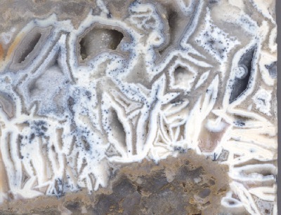
Calcite and quartz have opposing stabilities when it comes to favorable precipitating conditions. Where one forms, the other often dissolves either completely or partially. This is one of the most obvious of the many complex reactions that go on in a hot springs. Hot springs geochemistry differs from laboratory chemistry because in a hot springs the "beaker" is reacting with the solution that boils inside of it! So, at any given point in the roots of the hot springs, the water chemistry is different. In the example above left, bladed calcite was encrusted with chalcedony. As the chalcedony layers grew over the calcite, the calcite dissolved, leaving only a mold of the original eye-shaped crystals. These legacy crystal forms or "pseudomorphs," are very common in the boiling zone of a hot springs where pressure/temperature conditions are constantly shifting. These beautiful patterns exemplify the violent conditions in the heart of the ancient hot springs that formed the McLaughlin deposit. D. Enderlin scan. |
||||
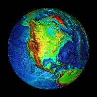
| Animated globe
courtesy NOAA NESDIS National Geophysical Data Center
Northern California digital terrain model adapted from Microsoft Terraserver data. |
|||||